
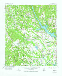
1959 Map of Elmore
USGS Topo · Published 1960About this map
Jordan Lake and the Coosa River dominate the eastern landscape of this late 1950s survey, where the Jordan Dam regulates the water levels above Parker Island. The central corridor is defined by the Louisville and Nashville railroad, which links together small communities like Speigner, Deatsville, and Elmore. The presence of the Union Rosenwald Sch and the Sweetening Sch provides specific points of interest for those researching local educational history, while several family-named landmarks such as Zeigler Cem and Harris Chapel dot the countryside. The southern portion of the map reveals the confluence where the Coosa meets the Alabama River, featuring the Elmore Landing Field and the riverside community of Robinson Springs. This era captures a transition from rural homesteads and gravel pits to more established recreational and industrial sites.
Find a feature on this map
102 named features on this map. Tap any name to fly to it.
Don’t see what you’re looking for? This feature index may not catch every label — zoom into the map to look around manually.
Map Details
Editions of this 1959 Elmore Map
2 editions found
Other maps of this area

1891 · Clanton
USGS Topo · 1:125,000

1901 · Wetumpka
USGS Topo · 1:125,000

1901 · Wetumpka
USGS Topo · 1:62,500

1903 · Wetumpka
USGS Topo · 1:125,000

1927 · Montgomery
USGS Topo · 1:48,000

1930 · Montgomery
USGS Topo · 1:62,500

1953 · Montgomery
USGS Topo · 1:250,000

1956 · Montgomery
USGS Topo · 1:250,000

1957 · Montgomery
USGS Topo · 1:250,000

1957 · Autaugaville
USGS Topo · 1:62,500