1930 Map of Montgomery
USGS Topo · Published 1930About this map
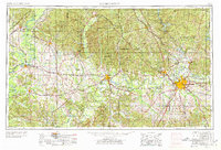
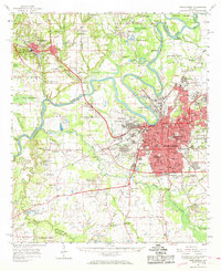
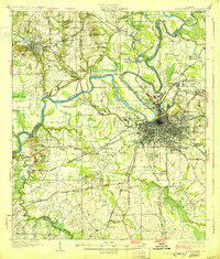
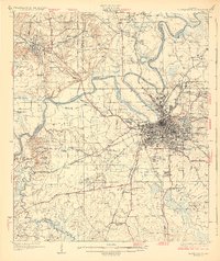
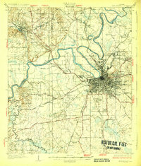
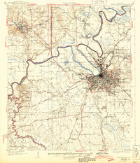
Montgomery stands as a significant rail and river hub on this 1930 edition survey, where the Alabama River meets a dense network of major transit lines including the Louisville and Nashville Railroad and the Atlantic Coast Line. The map documents the city's early 20th-century institutional landscape, featuring Maxwell Aviation Field, the Womans College of Alabama, and the Masonic Home. Beyond the urban core, the landscape is defined by the winding paths of Catoma Creek and the Tallapoosa River, while smaller settlements like Prattville and Millbrook appear alongside numerous rural landmarks. Genealogists and local historians can find a wealth of detail in the dozens of named churches and schools, such as Goodship Ch, Joppa Sch, and Mt Moriah Ch, which dot the countryside surrounding the capital city.
Find a feature on this map
105 named features on this map. Tap any name to fly to it.
Don’t see what you’re looking for? This feature index may not catch every label — zoom into the map to look around manually.
Map Details
Editions of this 1930 Montgomery Map
4 editions found
Historical Maps of Montgomery Through Time
7 maps found