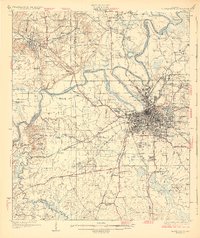
1930 Map of Montgomery
USGS Topo · Published 1930About this map
The confluence of the Coosa River and Tallapoosa River forms the headwaters of the Alabama River here, establishing a landscape defined by deep meanders and alluvial bottomlands like Savanna Swamp. Montgomery dominates the southeastern quadrant, shown in its transition towards modern urbanity with established neighborhoods like Cloverdale and Capital Heights bordered by the Womans College of Alabama. The city’s strategic rail importance is evident in the convergence of the Louisville and Nashville Railroad, Seaboard Air Line, and Western Railway of Alabama. Beyond the city center, the map documents early 20th-century aviation at Maxwell Aviation Field and social infrastructure at the Almshouse and Kilby Prison. To the northwest, Prattville stands as a significant industrial anchor along Autauga Creek, while numerous rural churches like Canyon Hill Ch and schools like Joppa Sch dot the surrounding countryside.
Find a feature on this map
112 named features on this map. Tap any name to fly to it.
Don’t see what you’re looking for? This feature index may not catch every label — zoom into the map to look around manually.
Map Details
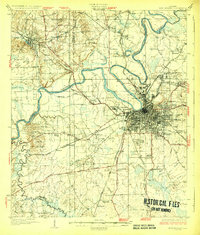
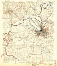
Editions of this 1930 Montgomery Map
4 editions found
Other maps of this area

1891 · Clanton
USGS Topo · 1:125,000

1901 · Wetumpka
USGS Topo · 1:125,000

1901 · Wetumpka
USGS Topo · 1:62,500

1903 · Wetumpka
USGS Topo · 1:125,000

1927 · Montgomery
USGS Topo · 1:48,000

1930 · Montgomery
USGS Topo · 1:62,500

1953 · Montgomery
USGS Topo · 1:250,000

1956 · Montgomery
USGS Topo · 1:250,000

1957 · Montgomery
USGS Topo · 1:250,000

1957 · Letohatchee
USGS Topo · 1:62,500