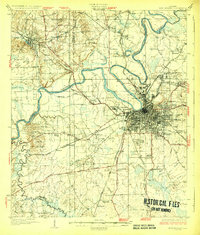
1930 Map of Montgomery
USGS Topo · Published 1930About this map
Montgomery serves as a major railway hub in the late 1920s, with five different lines including the Western Railway of Alabama and Louisville and Nashville Railroad converging on the city. The landscape is defined by the winding Alabama River, where older transit methods like Washington Ferry Road meet modern aviation at Maxwell Aviation Field. This survey captures the capital city during a period of institutional expansion, evidenced by the presence of Kilby Prison, the Tuberculosis Hospital, and the Womans College of Alabama. Beyond the urban core, the map detail provides a high density of rural social centers for genealogists to trace, from the Masonic Home to local landmarks like Joppa Sch and Stones Chapel. Several named hills like McQueen Hill and Arant Hill break up the river terrace topography between Prattville and the city center.
Find a feature on this map
103 named features on this map. Tap any name to fly to it.
Don’t see what you’re looking for? This feature index may not catch every label — zoom into the map to look around manually.
Map Details
Editions of this 1930 Montgomery Map
4 editions found
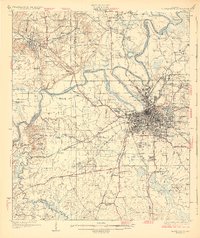
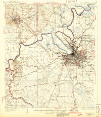
Other maps of this area

1891 · Clanton
USGS Topo · 1:125,000

1901 · Wetumpka
USGS Topo · 1:125,000

1901 · Wetumpka
USGS Topo · 1:62,500

1903 · Wetumpka
USGS Topo · 1:125,000

1927 · Montgomery
USGS Topo · 1:48,000

1930 · Montgomery
USGS Topo · 1:62,500

1953 · Montgomery
USGS Topo · 1:250,000

1956 · Montgomery
USGS Topo · 1:250,000

1957 · Montgomery
USGS Topo · 1:250,000

1957 · Letohatchee
USGS Topo · 1:62,500