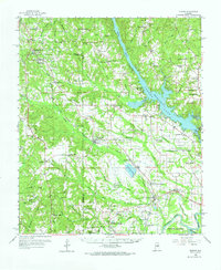
1959 Map of Elmore
USGS Topo · Published 1974About this map
The Coosa River and the expansive Jordan Lake dominate the eastern landscape of this 1959 study, providing a clear view of the region's hydroelectric and industrial development near Jordan Dam. The topography reflects a transition from the rolling terrain of the Chilton and Autauga borders toward the river valleys. The Louisville and Nashville railroad corridor serves as the primary backbone for settlements such as Deatsville, Speigner, and Elmore, showing the enduring influence of rail transit on local geography. Genealogists will find a dense network of country churches and schools, including the Union Rosenwald Sch and numerous family-named landmarks like Harris Chapel and McKeithen Cem. The southern portion of the map is defined by the confluence near the Alabama River and the Tallapoosa River, featuring Parker Island and the specialized infrastructure at the Landing Field.
Find a feature on this map
107 named features on this map. Tap any name to fly to it.
Don’t see what you’re looking for? This feature index may not catch every label — zoom into the map to look around manually.
Map Details
Editions of this 1959 Elmore Map
2 editions found

Other maps of this area

1891 · Clanton
USGS Topo · 1:125,000

1901 · Wetumpka
USGS Topo · 1:125,000

1901 · Wetumpka
USGS Topo · 1:62,500

1903 · Wetumpka
USGS Topo · 1:125,000

1927 · Montgomery
USGS Topo · 1:48,000

1930 · Montgomery
USGS Topo · 1:62,500

1953 · Montgomery
USGS Topo · 1:250,000

1956 · Montgomery
USGS Topo · 1:250,000

1957 · Montgomery
USGS Topo · 1:250,000

1957 · Autaugaville
USGS Topo · 1:62,500