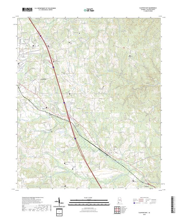
2024 Map of Clanton East
USGS Topo · Published 2024About this map
Clanton serves as the primary hub of this 2024 landscape, where the modern transport corridor of I-65 bisects the terrain. The area is defined by a dense network of country roads, including Co RD 89 and Co RD 28, which link together small settlements like Falakto, Cooper, and Verbena. A notable concentration of cemeteries and churches, such as Oak Grove Church of God Cem and Aldridge Family Cem, speaks to the deeply rooted local history of Chilton County.
Find a feature on this map
162 named features on this map. Tap any name to fly to it.
Don’t see what you’re looking for? This feature index may not catch every label — zoom into the map to look around manually.
Map Details
Editions of this 2024 Clanton East Map
This is the sole edition of this map. No revisions or reprints were ever made.
Other maps of this area

1891 · Clanton
USGS Topo · 1:125,000

1901 · Wetumpka
USGS Topo · 1:125,000

1903 · Wetumpka
USGS Topo · 1:125,000

1953 · Montgomery
USGS Topo · 1:250,000

1956 · Montgomery
USGS Topo · 1:250,000

1957 · Montgomery
USGS Topo · 1:250,000

1959 · Billingsley
USGS Topo · 1:62,500

1959 · Elmore
USGS Topo · 1:62,500
1971 · Mitchell Dam NW
USGS Topo · 1:24,000
1971 · Mitchell Dam
USGS Topo · 1:24,000