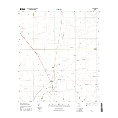
2015 Map of Clara
USGS Topo · Published 2015About this map
The Steinhatchee River flows through this corner of the Florida Big Bend, defining the natural borders between Taylor, Dixie, and Lafayette Counties. This 2015 survey shows a landscape dominated by the river's winding path and its tributaries, including Eightmile Creek and Kettle Creek. The small settlements of Clara and Tennille anchor the local road network, positioned along S SR 51. These communities are surrounded by a dense grid of rural routes, such as Jones Grade Rd and Camp Grade Rd, which reflect the area's history of timber and land management. Notable hydrologic features like Steinhatchee Spring and Iron Spring highlight the region's karst topography, where groundwater frequently reaches the surface to feed the river system.
Find a feature on this map
80 named features on this map. Tap any name to fly to it.
Don’t see what you’re looking for? This feature index may not catch every label — zoom into the map to look around manually.
Map Details
Editions of this 2015 Clara Map
This is the sole edition of this map. No revisions or reprints were ever made.
Other maps of this area

1954 · Mallory Swamp NW
USGS Topo · 1:24,000

1954 · Cross City West
USGS Topo · 1:24,000

1954 · Clara
USGS Topo · 1:24,000

1954 · Salem SW
USGS Topo · 1:24,000

1954 · Mallory Swamp SW
USGS Topo · 1:24,000

1954 · Jena
USGS Topo · 1:24,000

1954 · Cooks Hammock
USGS Topo · 1:24,000

1954 · Salem
USGS Topo · 1:24,000

1954 · Steinhatchee
USGS Topo · 1:24,000

1954 · Gainesville
USGS Topo · 1:250,000