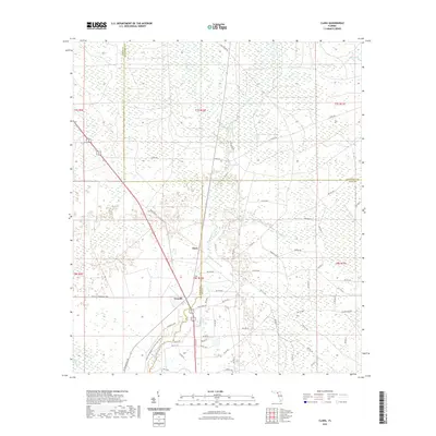
2021 Map of Clara
USGS Topo · Published 2021About this map
The Steinhatchee River defines the landscape of this Florida Gulf Coast region, winding through a network of wetlands and springs at the intersection of Taylor, Lafayette, and Dixie counties. Small settlements like Clara and Tennille anchor the local road system, which is characterized by numerous gridded avenues and grades such as Jones Grade Rd and S Canal Rd. The terrain is dominated by the sprawling Mud Swamp and various tributary creeks, including Eightmile Cr and Mud Cr.
Find a feature on this map
70 named features on this map. Tap any name to fly to it.
Don’t see what you’re looking for? This feature index may not catch every label — zoom into the map to look around manually.
Map Details
Editions of this 2021 Clara Map
This is the sole edition of this map. No revisions or reprints were ever made.
Other maps of this area

1954 · Mallory Swamp NW
USGS Topo · 1:24,000

1954 · Cross City West
USGS Topo · 1:24,000

1954 · Clara
USGS Topo · 1:24,000

1954 · Salem SW
USGS Topo · 1:24,000

1954 · Mallory Swamp SW
USGS Topo · 1:24,000

1954 · Jena
USGS Topo · 1:24,000

1954 · Cooks Hammock
USGS Topo · 1:24,000

1954 · Salem
USGS Topo · 1:24,000

1954 · Steinhatchee
USGS Topo · 1:24,000

1954 · Gainesville
USGS Topo · 1:250,000