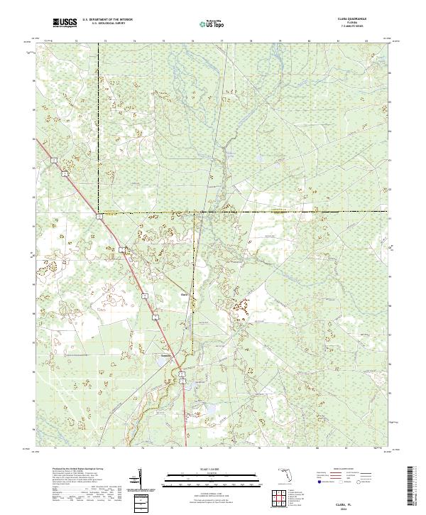
2024 Map of Clara
USGS Topo · Published 2024About this map
The Steinhatchee River carves through the convergence of Taylor, Dixie, and Lafayette Counties, anchoring a landscape defined by wetlands and freshwater springs. This modern topographic view highlights the small settlements of Clara and Tennille, which sit along the primary road corridor through this rural pine and swamp country. To the north, Steinhatchee Spring and Iron Spring emerge near the riverbanks, illustrating the hydrological character of the region. The map reveals an extensive network of timber and access roads, such as Jones Grade Rd and S Canal Rd, which crisscross the low-lying terrain near Mud Swamp. For those tracking the natural geography of the Florida Panhandle, the Lower Steinhatchee Conservation Area Trl provides a clear path through protected lands, while smaller tributaries like Kettle Creek and Eightmile Creek feed into the main river system.
Find a feature on this map
71 named features on this map. Tap any name to fly to it.
Don’t see what you’re looking for? This feature index may not catch every label — zoom into the map to look around manually.
Map Details
Editions of this 2024 Clara Map
This is the sole edition of this map. No revisions or reprints were ever made.
Other maps of this area

1954 · Mallory Swamp NW
USGS Topo · 1:24,000

1954 · Cross City West
USGS Topo · 1:24,000

1954 · Clara
USGS Topo · 1:24,000

1954 · Salem SW
USGS Topo · 1:24,000

1954 · Mallory Swamp SW
USGS Topo · 1:24,000

1954 · Jena
USGS Topo · 1:24,000

1954 · Cooks Hammock
USGS Topo · 1:24,000

1954 · Salem
USGS Topo · 1:24,000

1954 · Steinhatchee
USGS Topo · 1:24,000

1954 · Gainesville
USGS Topo · 1:250,000