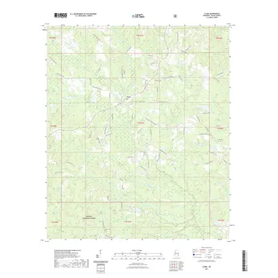
2021 Map of Clara
USGS Topo · Published 2021About this map
Clara stands as the central hub of this Wayne County landscape, surrounded by a dense network of family-named roads and drainage systems. The settlement is positioned near the confluence of Big Cr and Maynor Cr, reflecting a traditional Mississippi rural development pattern where small communities anchored the surrounding timberlands and family farms. Significant portions of the southern terrain are protected within the De Soto National Forest, maintaining the wooded character of the region.
Find a feature on this map
73 named features on this map. Tap any name to fly to it.
Don’t see what you’re looking for? This feature index may not catch every label — zoom into the map to look around manually.
Map Details
Editions of this 2021 Clara Map
This is the sole edition of this map. No revisions or reprints were ever made.
Other maps of this area

1953 · Hattiesburg
USGS Topo · 1:250,000

1958 · Hattiesburg
USGS Topo · 1:250,000

1964 · Denham
USGS Topo · 1:24,000

1964 · Knobtown
USGS Topo · 1:24,000

1964 · Clara
USGS Topo · 1:24,000

1964 · Mulberry
USGS Topo · 1:24,000

1964 · Waynesboro
USGS Topo · 1:24,000

1964 · Whistler
USGS Topo · 1:24,000

1964 · Buckatunna
USGS Topo · 1:24,000

1964 · Piave
USGS Topo · 1:24,000