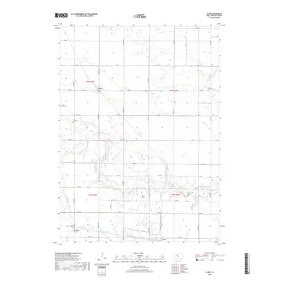
2018 Map of Clare
USGS Topo · Published 2018About this map
The agrarian landscape of Webster County is defined by the winding course of Lizard Creek and its various tributaries, including Bradys Cr and Deer Cr. This 2018 survey reveals a rural structure established long ago, with the small settlements of Clare and Barnum serving as focal points for the surrounding township sections. The map is particularly rich in genealogical sites, featuring several dispersed burial grounds that speak to the area's early European settlement patterns, such as Saint James Cem and the Trinity Lutheran Cem.
Find a feature on this map
47 named features on this map. Tap any name to fly to it.
Don’t see what you’re looking for? This feature index may not catch every label — zoom into the map to look around manually.
Map Details
Editions of this 2018 Clare Map
This is the sole edition of this map. No revisions or reprints were ever made.
Other maps of this area

1923 · Lehigh
USGS Topo · 1:62,500

1923 · Fort Dodge
USGS Topo · 1:62,500

1954 · Fort Dodge
USGS Topo · 1:250,000

1957 · Fort Dodge
USGS Topo · 1:250,000

1958 · Fort Dodge
USGS Topo · 1:250,000

1965 · Moorland
USGS Topo · 1:24,000

1965 · Fort Dodge South
USGS Topo · 1:24,000

1965 · Knierim
USGS Topo · 1:24,000
1979 · Fort Dodge North
USGS Topo · 1:24,000

1979 · Humboldt
USGS Topo · 1:24,000