2022 Map of Clare
USGS Topo · Published 2022About this map
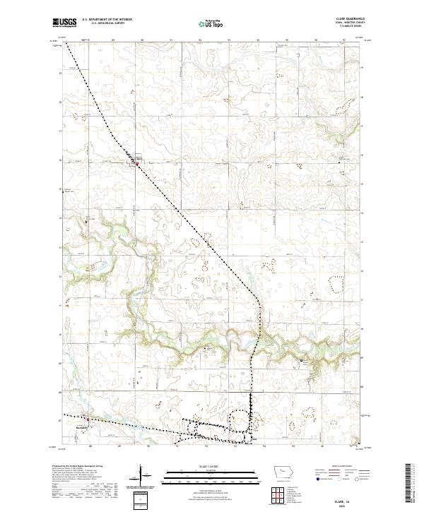
Clare and Barnum anchor this rural landscape in Webster County, where the grid of county roads meets the winding courses of Lizard Creek and its tributaries. The map reveals a deeply rooted agricultural community defined by its local institutions and family landmarks. Genealogists will find significant value in the distribution of burial sites across the township, including Saint James Cem and the Trinity Lutheran Cem, as well as the small Burns Family Plot near Hidden Valley Rd. The hydrological network is complex, featuring the South Branch Lizard Creek and the engineered Drainage Ditch Number 219, reflecting the region's long-standing efforts to manage the prairie watershed for farming. At the southern edge, the settlement of Tara sits near the rail corridor, while the north is drained by Bradys Cr and Deer Cr.
Find a feature on this map
47 named features on this map. Tap any name to fly to it.
Don’t see what you’re looking for? This feature index may not catch every label — zoom into the map to look around manually.
Map Details
Editions of this 2022 Clare Map
This is the sole edition of this map. No revisions or reprints were ever made.
Historical Maps of Douglas Township Through Time
Featured Locations
- Deer Creek Township, IA
- Douglas Township, IA
- Jackson Township, IA
- Clare, Jackson Township
- Barnum, Johnson Township