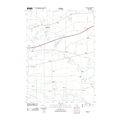
2010 Map of Clarence
USGS Topo · Published 2010About this map
Clarence and the surrounding Erie County landscape are defined by a network of creeks and small settlements transitioning from rural foundations to modern development. Historically significant hamlets like Looneyville, Wende, and Millgrove are clustered between major watercourses such as Ellicott Creek and Cayuga Creek. The map provides exceptional detail for genealogists, documenting numerous burial sites including Clarence Fillmore Cemetery, Ledge Lawn Cemetery, and the German Lutheran Cemetery. The area’s agricultural and recreational character is evident through landmarks like The Great Pumpkin Farm and Ulbrichs Tree Farm, while transportation hubs such as Town Line Station and the Lancaster Airport Incorporated Airport show the infrastructure supporting this part of Western New York. Geographic features like West Hill, East Hill, and Sand Ridge provide the relief that directs the flow of Ransom Creek and Plum Bottom Creek.
Find a feature on this map
80 named features on this map. Tap any name to fly to it.
Don’t see what you’re looking for? This feature index may not catch every label — zoom into the map to look around manually.
Map Details
Editions of this 2010 Clarence Map
This is the sole edition of this map. No revisions or reprints were ever made.
Other maps of this area

1897 · Medina
USGS Topo · 1:62,500

1897 · Lockport
USGS Topo · 1:62,500

1899 · Niagara
USGS Topo · 1:125,000

1902 · Lockport
USGS Topo · 1:62,500

1905 · Attica
USGS Topo · 1:62,500

1905 · Depew
USGS Topo · 1:62,500

1905 · Lockport
USGS Topo · 1:62,500

1948 · Depew
USGS Topo · 1:62,500

1948 · Lockport
USGS Topo · 1:62,500

1949 · Attica
USGS Topo · 1:62,500