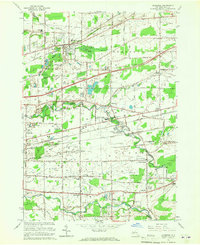
1965 Map of Clarence
USGS Topo · Published 1967About this map
Industrial and agricultural land uses define this portion of Erie County during the mid-1960s, a landscape shaped by three major rail lines and the New York State Thruway. The presence of the County Penitentiary (Industrial Farm) and the County Home and Infirmary near Wende highlights the region's historical role in providing public institutional space. Settlement patterns are concentrated along the historical corridors of Main Street and Genesee Street, where established towns like Clarence and Alden serve as local hubs.
Find a feature on this map
52 named features on this map. Tap any name to fly to it.
Don’t see what you’re looking for? This feature index may not catch every label — zoom into the map to look around manually.
Map Details
Editions of this 1965 Clarence Map
This is the sole edition of this map. No revisions or reprints were ever made.
Other maps of this area

1897 · Medina
USGS Topo · 1:62,500

1897 · Lockport
USGS Topo · 1:62,500

1899 · Niagara
USGS Topo · 1:125,000

1902 · Lockport
USGS Topo · 1:62,500

1905 · Attica
USGS Topo · 1:62,500

1905 · Depew
USGS Topo · 1:62,500

1905 · Lockport
USGS Topo · 1:62,500

1948 · Depew
USGS Topo · 1:62,500

1948 · Lockport
USGS Topo · 1:62,500

1949 · Attica
USGS Topo · 1:62,500