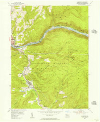
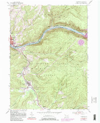
1954 Map of Clarendon
USGS Topo · Published 1956About this map
Allegheny River frontage and the industrial heritage of the Oil Field dominate this mid-century portrait of Warren County. The map documents a landscape defined by the extraction economy, where dense clusters of gas and oil wells dot the terrain near Clarendon and Glade Field. The valley of the Tionesta Creek serves as a primary corridor for the Pennsylvania Railroad and Pennsylvania 120, connecting settlements like Weldbank, Old Clarendon, and Tiona.
Find a feature on this map
55 named features on this map. Tap any name to fly to it.
Don’t see what you’re looking for? This feature index may not catch every label — zoom into the map to look around manually.
Map Details
Editions of this 1954 Clarendon Map
5 editions found
Other maps of this area

1906 · Warren
USGS Topo · 1:62,500

1907 · Warren
USGS Topo · 1:62,500

1908 · Warren
USGS Topo · 1:62,500

1934 · Kane
USGS Topo · 1:48,000

1935 · Sheffield
USGS Topo · 1:48,000

1936 · Kinzua
USGS Topo · 1:48,000

1939 · Kane
USGS Topo · 1:62,500

1941 · Sheffield
USGS Topo · 1:62,500

1941 · Kinzua
USGS Topo · 1:62,500

1947 · Cherry Grove
USGS Topo · 1:24,000