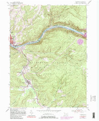
1954 Map of Clarendon
USGS Topo · Published 1981About this map
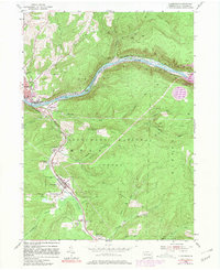
The Allegheny River snakes through the northern reaches of the Allegheny National Forest, defining a landscape where industrial extraction and timberlands meet. This era in Warren County is marked by the extensive Glade Oil Field and numerous Gas Wells dotting the northern ridges above Warren. The Penn Central rail line follows the river's path, passing through islands like Harmon Island and Dixon Island before turning south to service the corridor of settlements along Dutchman Run.
Find a feature on this map
55 named features on this map. Tap any name to fly to it.
Don’t see what you’re looking for? This feature index may not catch every label — zoom into the map to look around manually.
Map Details
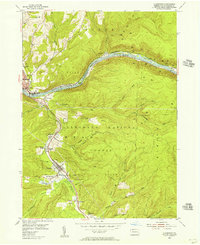
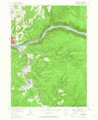
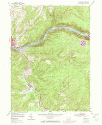
Editions of this 1954 Clarendon Map
5 editions found
Other maps of this area

1906 · Warren
USGS Topo · 1:62,500

1907 · Warren
USGS Topo · 1:62,500

1908 · Warren
USGS Topo · 1:62,500

1934 · Kane
USGS Topo · 1:48,000

1935 · Sheffield
USGS Topo · 1:48,000

1936 · Kinzua
USGS Topo · 1:48,000

1939 · Kane
USGS Topo · 1:62,500

1941 · Sheffield
USGS Topo · 1:62,500

1941 · Kinzua
USGS Topo · 1:62,500

1947 · Cherry Grove
USGS Topo · 1:24,000