
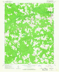
2010 Map of Claresville
USGS Topo · Published 2010About this map
Fountains Creek and its many tributaries, including Cypress Creek and Mill Swamp, define the hydrologic landscape of this rural corridor along the Virginia and North Carolina border. The area is characterized by low-lying wetlands and managed water bodies like Taylors Millpond, which is retained by Bryants Dam. Small agricultural settlements and rural junctions like Claresville, Bryants Corner, and Turners Crossroads serve as the primary hubs for the local community, connected by a network of winding roads such as Peanut Market Rd and the Brantley Moore Tpke. The transition from the Meherrin River in the northeast to the various swamps and ponds in the south reveals a landscape deeply tied to water management and agricultural production. Researchers can trace land use patterns near Gilahi Farm or follow the course of Jordans Millpond and Ivy Creek as they traverse this quiet interior region.
Find a feature on this map
27 named features on this map. Tap any name to fly to it.
Don’t see what you’re looking for? This feature index may not catch every label — zoom into the map to look around manually.
Map Details
Editions of this 2010 Claresville Map
This is the sole edition of this map. No revisions or reprints were ever made.
Other maps of this area

1919 · Emporia
USGS Topo · 1:62,500

1919 · Arringdale
USGS Topo · 1:48,000

1920 · Arringdale
USGS Topo · 1:62,500

1942 · Arringdale
USGS Topo · 1:62,500

1942 · Emporia
USGS Topo · 1:62,500

1953 · Norfolk
USGS Topo · 1:250,000

1963 · Skippers
USGS Topo · 1:24,000

1963 · Emporia
USGS Topo · 1:24,000
1966 · Drewryville
USGS Topo · 1:24,000

1966 · Margarettsville
USGS Topo · 1:24,000