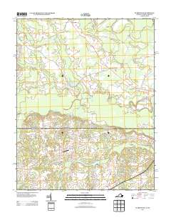
2013 Map of Claresville
USGS Topo · Published 2013About this map
The borderlands of Virginia and North Carolina are defined by a complex network of slow-moving water and agricultural bypasses in this 2013 survey. Claresville and Bryants Corner anchor the northern landscape, where the Brantley Moore Tpke and Low Ground Rd traverse a terrain heavily influenced by the drainage of Mill Swamp and Caney Swamp. This area reflects the long-standing agricultural traditions of the region, notably evidenced by the presence of Peanut Market Rd and the centralized Bryants Millpond.
Find a feature on this map
39 named features on this map. Tap any name to fly to it.
Don’t see what you’re looking for? This feature index may not catch every label — zoom into the map to look around manually.
Map Details
Editions of this 2013 Claresville Map
This is the sole edition of this map. No revisions or reprints were ever made.
Other maps of this area

1919 · Emporia
USGS Topo · 1:62,500

1919 · Arringdale
USGS Topo · 1:48,000

1920 · Arringdale
USGS Topo · 1:62,500

1942 · Arringdale
USGS Topo · 1:62,500

1942 · Emporia
USGS Topo · 1:62,500

1953 · Norfolk
USGS Topo · 1:250,000

1963 · Skippers
USGS Topo · 1:24,000

1963 · Emporia
USGS Topo · 1:24,000
1966 · Drewryville
USGS Topo · 1:24,000

1966 · Margarettsville
USGS Topo · 1:24,000