
1978 Map of Clarinda North
USGS Topo · Published 1978About this map
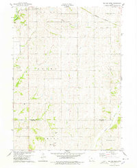
Clarinda anchors the southern portion of this Page County landscape, dominated by the expansive grounds of the Clarinda Mental Health Institute. To the north, the small rural centers of Bethesda and Hepburn punctuate a terrain defined by the drainage basins of East Tarkio Creek and the West Nodaway River. The transportation network reveals a transition in Iowa's agricultural infrastructure, showing the active Burlington Northern line following the river valley while an Old Railroad Grade suggests a decommissioned route through the western hills. Genealogists and local historians will find significant rural landmarks, including the Rose Hill Ch and Immanuel Sch, along with numerous unnamed Cem sites. These features, along with engineered water management like Ditch No 10, illustrate the mid-century evolution of the Nodaway and Valley townships.
Find a feature on this map
22 named features on this map. Tap any name to fly to it.
Don’t see what you’re looking for? This feature index may not catch every label — zoom into the map to look around manually.
Map Details
Editions of this 1978 Clarinda North Map
This is the sole edition of this map. No revisions or reprints were ever made.
Other maps of this area

1940 · Coin
USGS Topo · 1:62,500

1940 · New Market
USGS Topo · 1:62,500

1943 · Coin
USGS Topo · 1:62,500

1943 · New Market
USGS Topo · 1:62,500

1955 · Nebraska City
USGS Topo · 1:250,000

1957 · Nebraska City
USGS Topo · 1:250,000

1958 · Nebraska City
USGS Topo · 1:250,000

1978 · Stanton
USGS Topo · 1:24,000

1978 · Stanton SW
USGS Topo · 1:24,000
1978 · Red Oak South
USGS Topo · 1:24,000