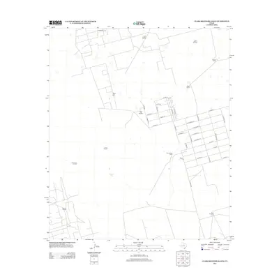
2012 Map of Clark Brothers Ranch
USGS Topo · Published 2012About this map
South Cowden Oil Field and the Double H Oil Field dominate the upper portion of this Ector County landscape, reflecting the intensive petroleum extraction character of the Permian Basin in the early 21st century. The map reveals a rigid grid of residential streets south of these fields, many named for fruits and gemstones, such as W Orange St, W Lime St, and S Agate Ave. This planned settlement contrasts with the surrounding agricultural and ranching operations. Scattered throughout the territory are numerous family and place-named water sources essential for livestock, including Henderson Windmill, Simms Tank, and the Prairie Dog Windmill. The namesake Clark Brothers Ranch sits centrally, serving as a landmark between the industrial oil zones to the north and the expanding residential outskirts of Pleasant Farms.
Find a feature on this map
39 named features on this map. Tap any name to fly to it.
Don’t see what you’re looking for? This feature index may not catch every label — zoom into the map to look around manually.
Map Details
Editions of this 2012 Clark Brothers Ranch Map
This is the sole edition of this map. No revisions or reprints were ever made.
Other maps of this area

1954 · Pecos
USGS Topo · 1:250,000

1957 · Pecos
USGS Topo · 1:250,000

1964 · Odessa SW
USGS Topo · 1:24,000

1964 · Odessa SE
USGS Topo · 1:24,000

1964 · Douro
USGS Topo · 1:24,000

1964 · Doodle Bug Well
USGS Topo · 1:24,000

1964 · Penwell
USGS Topo · 1:24,000

1964 · Penwell SE
USGS Topo · 1:24,000

1964 · Clark Brothers Ranch
USGS Topo · 1:24,000

1964 · Perkins Lake
USGS Topo · 1:24,000