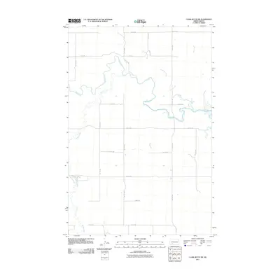
2011 Map of Clark Butte NW
USGS Topo · Published 2011About this map
Heart River meanders across this rural Stark County landscape, carving a complex series of oxbows and bends that define the central hydrology of the area. This portion of North Dakota is characterized by a disciplined grid of section-line roads, such as 80th Ave SW and 47th Ave SW, which facilitate the region's agricultural movement. The drainage network is further supported by Buffalo Creek in the southwest and Government Creek to the north, both tributaries that feed into the larger river system. While largely open land, the map records the specific arterial routes like Burt Rd that connect isolated farmsteads and rural properties. The landscape is a study in prairie water management, where Spring Creek and other small waterways intersect with the straight-line human geometry of the Great Plains survey system.
Find a feature on this map
19 named features on this map. Tap any name to fly to it.
Don’t see what you’re looking for? This feature index may not catch every label — zoom into the map to look around manually.
Map Details
Editions of this 2011 Clark Butte NW Map
This is the sole edition of this map. No revisions or reprints were ever made.
Other maps of this area

1953 · Dickinson
USGS Topo · 1:250,000

1957 · Dickinson
USGS Topo · 1:250,000

1960 · Clark Butte NW
USGS Topo · 1:24,000

1960 · Clark Butte NE
USGS Topo · 1:24,000

1960 · White Butte NE
USGS Topo · 1:24,000

1960 · Clark Butte SW
USGS Topo · 1:24,000

1960 · White Butte East
USGS Topo · 1:24,000

1960 · Clark Butte
USGS Topo · 1:24,000
1973 · Hebron SE
USGS Topo · 1:24,000

1973 · Richardton SE
USGS Topo · 1:24,000