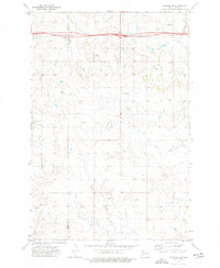
1973 Map of Hebron SE
USGS Topo · Published 1977About this map
The Stark Co Morton Co line bisects this prairie landscape as it appeared in the early 1970s. The northern portion is dominated by the modern transport corridor of 94 and 10, including a roadside Rest Area, while the lower half of the quadrangle shows a more traditional agricultural and hydrologic pattern. Heart Butte Creek and Beaver Creek wind through the terrain, with several unnamed Spring features dotting the coulees and draws. The map illustrates a transitional period in rural North Dakota, where large-scale infrastructure like a major Pipeline and a Storage Bin exist alongside smaller local landmarks such as Schmidt. For the researcher, the sheet provides a precise look at the section lines and topography before further agricultural consolidation.
Find a feature on this map
11 named features on this map. Tap any name to fly to it.
Don’t see what you’re looking for? This feature index may not catch every label — zoom into the map to look around manually.
Map Details
Editions of this 1973 Hebron SE Map
This is the sole edition of this map. No revisions or reprints were ever made.
Other maps of this area

1938 · Heart Butte
USGS Topo · 1:48,000

1944 · Heart Butte
USGS Topo · 1:62,500

1953 · Dickinson
USGS Topo · 1:250,000

1954 · Bismarck
USGS Topo · 1:250,000

1957 · Dickinson
USGS Topo · 1:250,000

1958 · Bismarck
USGS Topo · 1:250,000

1960 · Clark Butte NW
USGS Topo · 1:24,000

1960 · Heart Butte NW
USGS Topo · 1:24,000

1960 · Clark Butte NE
USGS Topo · 1:24,000
1970 · Glen Ullin NW
USGS Topo · 1:24,000