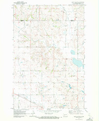
1970 Map of Glen Ullin NW
USGS Topo · Published 1972About this map
St Clements Ch and the high ground of Eagles Nest anchor this 1970 landscape on the border of Mercer and Morton counties. The terrain is defined by the winding course of Elm Creek and numerous smaller water sources labeled simply as Spring. This survey captures the rural infrastructure of the early 1970s, including the path of the Burlington Northern railroad cutting through the southwestern corner. Evidence of local industry and road maintenance is visible in the scattered Gravel Pit and larger Gravel Pits found near the southern ridge. The map also meticulously documents property boundaries with fine red dashed lines, marking the field and fence lines as they appeared during aerial photography in the late 1960s.
Find a feature on this map
8 named features on this map. Tap any name to fly to it.
Don’t see what you’re looking for? This feature index may not catch every label — zoom into the map to look around manually.
Map Details
Editions of this 1970 Glen Ullin NW Map
This is the sole edition of this map. No revisions or reprints were ever made.
Other maps of this area

1953 · Dickinson
USGS Topo · 1:250,000

1953 · Watford City
USGS Topo · 1:250,000

1954 · Bismarck
USGS Topo · 1:250,000

1954 · McClusky
USGS Topo · 1:250,000

1957 · Dickinson
USGS Topo · 1:250,000

1957 · Watford City
USGS Topo · 1:250,000

1958 · Bismarck
USGS Topo · 1:250,000

1958 · McClusky
USGS Topo · 1:250,000

1960 · Glen Ullin
USGS Topo · 1:24,000

1967 · Watford City
USGS Topo · 1:250,000