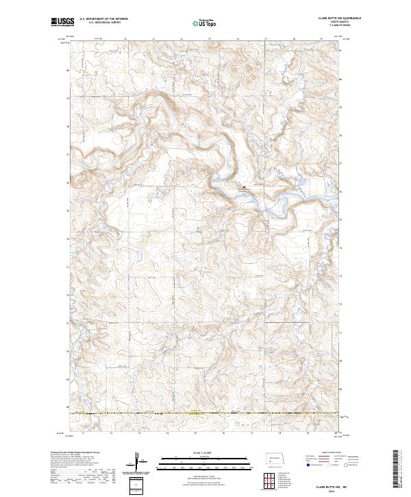
2024 Map of Clark Butte NW
USGS Topo · Published 2024About this map
Heart River winds through this rural landscape on the border of Stark and Hettinger counties, defining a terrain of deep drainages and tributary creeks. The land is marked by a distinctive grid of township and range lines, including t137n r91w and t138n r91w, which organize the homesteads and farms of this prairie region. Near the center of the sheet, the Bethesda German Congregational Cem serves as a significant landmark for genealogical research, reflecting the specific cultural and religious heritage of the early settlers who established roots in these townships. The drainage network, including Government Creek, Spring Creek, and Buffalo Creek, dictates the placement of the local road system, which follows a rigid sectional pattern of numbered streets and avenues.
Find a feature on this map
27 named features on this map. Tap any name to fly to it.
Don’t see what you’re looking for? This feature index may not catch every label — zoom into the map to look around manually.
Map Details
Editions of this 2024 Clark Butte NW Map
This is the sole edition of this map. No revisions or reprints were ever made.
Other maps of this area

1953 · Dickinson
USGS Topo · 1:250,000

1957 · Dickinson
USGS Topo · 1:250,000

1960 · Clark Butte NW
USGS Topo · 1:24,000

1960 · Clark Butte NE
USGS Topo · 1:24,000

1960 · White Butte NE
USGS Topo · 1:24,000

1960 · Clark Butte SW
USGS Topo · 1:24,000

1960 · White Butte East
USGS Topo · 1:24,000

1960 · Clark Butte
USGS Topo · 1:24,000
1973 · Hebron SE
USGS Topo · 1:24,000

1973 · Richardton SE
USGS Topo · 1:24,000