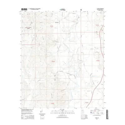
2015 Map of Clark
USGS Topo · Published 2015About this map
Old Avera and Clark sit within the timberlands and river bottoms of Greene County, where the Chickasawhay River meanders through the center of this landscape. The terrain is defined by a dense network of tributaries including Griffin Cr, Morgan Mill Br, and Byrd Cr, reflecting the hydrologic complexity of the Pine Belt. While the Desoto National Forest occupies the northwestern corner, the rest of the map is a mosaic of family-named roads and rural burial grounds. For genealogists, the distribution of small cemeteries such as Adamsville Cem, Fellowship Cem, and Simpson Cem provides a clear spatial record of early settlement patterns and family clusters away from the primary river artery. The presence of routes like Clark Heritage Rd and Old Avera Rd suggests the enduring path of local travel between these small Mississippi communities.
Find a feature on this map
74 named features on this map. Tap any name to fly to it.
Don’t see what you’re looking for? This feature index may not catch every label — zoom into the map to look around manually.
Map Details
Editions of this 2015 Clark Map
This is the sole edition of this map. No revisions or reprints were ever made.
Other maps of this area

1942 · Deer Park
USGS Topo · 1:62,500

1943 · Deer Park
USGS Topo · 1:62,500

1953 · Hattiesburg
USGS Topo · 1:250,000

1958 · Hattiesburg
USGS Topo · 1:250,000

1964 · Knobtown
USGS Topo · 1:24,000

1964 · Clark
USGS Topo · 1:24,000

1964 · Avera
USGS Topo · 1:24,000

1964 · Piave
USGS Topo · 1:24,000

1972 · Leakesville
USGS Topo · 1:24,000

1973 · Jonathan
USGS Topo · 1:24,000