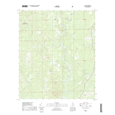
2018 Map of Clark
USGS Topo · Published 2018About this map
The Chickasawhay River winds through this Greene County landscape, serving as the central geographic feature for the small communities and rural tracts documented in 2018. Along its western banks, the settlement of Clark is situated near the Fellowship Cem, while further north, Old Avera sits at a crossroads near the Avera Cem. This area of Mississippi is defined by a dense network of creeks and branches, including Griffin Cr, Panther Br, and McKinnis Cr, which drain the heavily wooded sections of the De Soto National Forest. Genealogists will find several family-named burial grounds throughout the quadrangle, such as the Odom Cem and Platt Cem, which remain as anchor points for local history amidst the timberlands and winding roads like Polley Wiggle Rd and Clark Heritage Rd.
Find a feature on this map
66 named features on this map. Tap any name to fly to it.
Don’t see what you’re looking for? This feature index may not catch every label — zoom into the map to look around manually.
Map Details
Editions of this 2018 Clark Map
This is the sole edition of this map. No revisions or reprints were ever made.
Other maps of this area

1942 · Deer Park
USGS Topo · 1:62,500

1943 · Deer Park
USGS Topo · 1:62,500

1953 · Hattiesburg
USGS Topo · 1:250,000

1958 · Hattiesburg
USGS Topo · 1:250,000

1964 · Knobtown
USGS Topo · 1:24,000

1964 · Clark
USGS Topo · 1:24,000

1964 · Avera
USGS Topo · 1:24,000

1964 · Piave
USGS Topo · 1:24,000

1972 · Leakesville
USGS Topo · 1:24,000

1973 · Jonathan
USGS Topo · 1:24,000