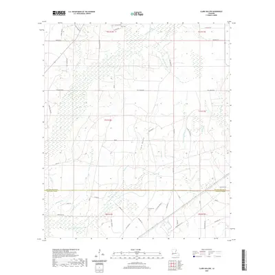
2020 Map of Clark Hollow
USGS Topo · Published 2020About this map
The borderlands of Beauregard Parish and Calcasieu Parish are defined by a intricate system of drainage gullies and creeks, most notably Indian Cr, Bear Head Cr, and the central drainage of Clark Hollow. This 2020 survey reveals a landscape largely shaped by rural infrastructure and water management, where numerous "gullies"—including Mustang Gully, White Oak Gully, and Sally Gully—feed into larger marsh systems. The distribution of family-named roads such as Edward Pickering Rd, Howell Pinder Rd, and Jack Coleman Rd suggests a community organized around established landholdings and timber or oil interests. Genealogists will find the locations of Hyatt Cem near the northern boundary and Stanley Cem further south to be vital points of reference. The presence of Sun Oil Rd and Mule Pond underscores the dual nature of this Louisiana landscape as both a resource extraction zone and a complex wetland environment.
Find a feature on this map
56 named features on this map. Tap any name to fly to it.
Don’t see what you’re looking for? This feature index may not catch every label — zoom into the map to look around manually.
Map Details
Editions of this 2020 Clark Hollow Map
This is the sole edition of this map. No revisions or reprints were ever made.
Other maps of this area

1947 · Starks
USGS Topo · 1:31,680

1947 · Carter Creek
USGS Topo · 1:31,680

1947 · DeQuincy
USGS Topo · 1:31,680

1947 · Sulphur Mines
USGS Topo · 1:31,680

1947 · Oretta
USGS Topo · 1:31,680

1947 · Hyatt
USGS Topo · 1:31,680

1947 · Lunita
USGS Topo · 1:31,680

1947 · Long Marsh
USGS Topo · 1:31,680

1949 · Bancroft
USGS Topo · 1:31,680

1952 · Lake Charles
USGS Topo · 1:250,000