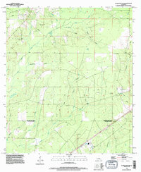
1994 Map of Clark Hollow
USGS Topo · Published 1996About this map
Indian Creek and Bear Head Creek carve through the lowlands of the Beauregard Parish and Calcasieu Parish border, creating a complex drainage network defined by deep gullies and marshes. The landscape is heavily marked by industrial activity, shown through numerous pipelines and drill holes that dot the wooded terrain. This 1990s revision reflects the area's continued reliance on resource extraction while maintaining its rural, water-rich character.
Find a feature on this map
24 named features on this map. Tap any name to fly to it.
Don’t see what you’re looking for? This feature index may not catch every label — zoom into the map to look around manually.
Map Details
Editions of this 1994 Clark Hollow Map
This is the sole edition of this map. No revisions or reprints were ever made.
Other maps of this area

1947 · Starks
USGS Topo · 1:31,680

1947 · Carter Creek
USGS Topo · 1:31,680

1947 · DeQuincy
USGS Topo · 1:31,680

1947 · Sulphur Mines
USGS Topo · 1:31,680

1947 · Oretta
USGS Topo · 1:31,680

1947 · Hyatt
USGS Topo · 1:31,680

1947 · Lunita
USGS Topo · 1:31,680

1947 · Long Marsh
USGS Topo · 1:31,680

1949 · Bancroft
USGS Topo · 1:31,680

1952 · Lake Charles
USGS Topo · 1:250,000