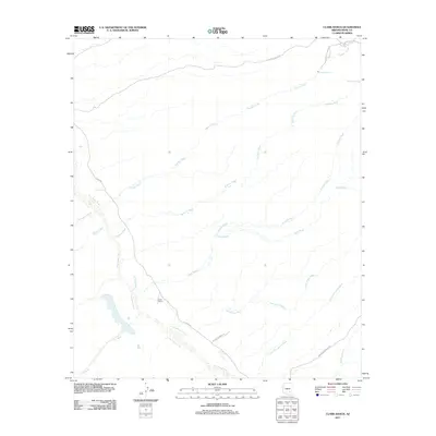
2011 Map of Clark Ranch
USGS Topo · Published 2011About this map
The San Pedro River flows through this arid corridor of Pinal County, serving as the primary geographic anchor for a landscape defined by seasonal washes and ranching history. The settlement at Clark Ranch sits at a junction of desert tracks, where River RD follows the river's path. This arid topography is intricately dissected by drainage systems such as Mulberry Wash, Clark Wash, and Gust James Wash, which channel water toward the San Pedro during the monsoon season.
Find a feature on this map
19 named features on this map. Tap any name to fly to it.
Don’t see what you’re looking for? This feature index may not catch every label — zoom into the map to look around manually.
Map Details
Editions of this 2011 Clark Ranch Map
This is the sole edition of this map. No revisions or reprints were ever made.
Other maps of this area

1911 · Winkelman
USGS Topo · 1:125,000

1913 · Winkelman
USGS Topo · 1:125,000

1938 · Galiuro Mts
USGS Topo · 1:48,000

1938 · Klondyke
USGS Topo · 1:48,000

1943 · Galiuro Mts
USGS Topo · 1:62,500

1943 · Klondyke
USGS Topo · 1:62,500

1948 · Clark Ranch
USGS Topo · 1:24,000

1948 · Mammoth
USGS Topo · 1:62,500

1948 · Mammoth
USGS Topo · 1:24,000

1948 · Campo Bonito
USGS Topo · 1:24,000