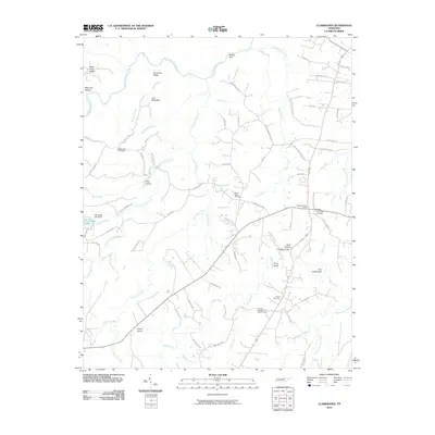
2010 Map of Clarkrange
USGS Topo · Published 2010About this map
Hurricane Ridge and Steel Tram Ridge dominate the northwestern landscape of this Cumberland Plateau region, where the headwaters of the East Fork Obey River have carved deep terrain features like Maynard Hollow and Balden Gulf. The settlement patterns here reflect a rural community structure centered around local landmarks such as Hickory Corner and the Clarkrange Post Office. A network of country cemeteries, including Rinnie Cemetery, Muddy Pond Cemetery, and Elmore Cemetery Number One, provides essential data points for genealogical research across the plateau. To the south, the terrain levels out somewhat as numerous branches feed into Clear Creek, while the presence of the D O Beaty Bridge and various local roads like Old Martha Washington Rd illustrate the established transit routes connecting these upland communities.
Find a feature on this map
85 named features on this map. Tap any name to fly to it.
Don’t see what you’re looking for? This feature index may not catch every label — zoom into the map to look around manually.
Map Details
Editions of this 2010 Clarkrange Map
This is the sole edition of this map. No revisions or reprints were ever made.
Other maps of this area

1895 · Wartburg
USGS Topo · 1:125,000

1896 · Wartburg
USGS Topo · 1:125,000

1897 · Standingstone
USGS Topo · 1:125,000

1898 · Standingstone
USGS Topo · 1:125,000

1935 · Isoline
USGS Topo · 1:24,000

1935 · Campbell Junction
USGS Topo · 1:24,000

1935 · Clarkrange
USGS Topo · 1:24,000

1936 · Fox Creek
USGS Topo · 1:24,000

1936 · Jones Knob
USGS Topo · 1:24,000
1946 · Fox Creek
USGS Topo · 1:24,000