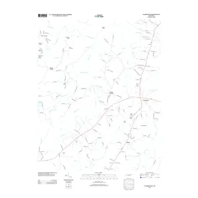
2013 Map of Clarkrange
USGS Topo · Published 2013About this map
Clarkrange and Rinnie serve as the primary nodes of settlement in this part of the Cumberland Plateau, where the landscape is defined by the headwaters of several major drainage systems. The northern reaches of the map are characterized by the steep relief of the Obey River basin, featuring landmarks like Steel Tram Ridge and the deeply incised Maynard Hollow. To the south and east, the terrain transitions into a labyrinth of creeks including Clear Cr and Slate Cr.
Find a feature on this map
143 named features on this map. Tap any name to fly to it.
Don’t see what you’re looking for? This feature index may not catch every label — zoom into the map to look around manually.
Map Details
Editions of this 2013 Clarkrange Map
This is the sole edition of this map. No revisions or reprints were ever made.
Other maps of this area

1895 · Wartburg
USGS Topo · 1:125,000

1896 · Wartburg
USGS Topo · 1:125,000

1897 · Standingstone
USGS Topo · 1:125,000

1898 · Standingstone
USGS Topo · 1:125,000

1935 · Isoline
USGS Topo · 1:24,000

1935 · Campbell Junction
USGS Topo · 1:24,000

1935 · Clarkrange
USGS Topo · 1:24,000

1936 · Fox Creek
USGS Topo · 1:24,000

1936 · Jones Knob
USGS Topo · 1:24,000
1946 · Fox Creek
USGS Topo · 1:24,000