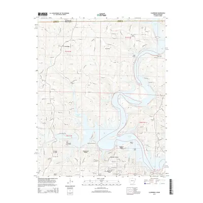
2014 Map of Clarkridge
USGS Topo · Published 2014About this map
Norfork Lake dominates the central landscape of this northern Arkansas survey, carving a complex shoreline through the hills of Baxter County. The settlement of Clarkridge sits just south of the Missouri border, serving as a focal point for a network of country roads like County Road 36 and County Road 786. This era shows a community increasingly defined by recreational and residential development near the water, evidenced by Dogwood Park, Kingswood Estates, and Lakeside Terrace.
Find a feature on this map
110 named features on this map. Tap any name to fly to it.
Don’t see what you’re looking for? This feature index may not catch every label — zoom into the map to look around manually.
Map Details
Editions of this 2014 Clarkridge Map
This is the sole edition of this map. No revisions or reprints were ever made.
Other maps of this area

1890 · Mountain Home
USGS Topo · 1:125,000

1891 · Mountain Home
USGS Topo · 1:125,000

1894 · Mountain Home
USGS Topo · 1:125,000

1934 · Gainesville
USGS Topo · 1:48,000

1940 · Gainesville
USGS Topo · 1:62,500

1944 · Cureall
USGS Topo · 1:62,500

1945 · Harrison
USGS Topo · 1:250,000

1946 · Cureall
USGS Topo · 1:62,500

1949 · Harrison
USGS Topo · 1:250,000

1954 · Harrison
USGS Topo · 1:250,000