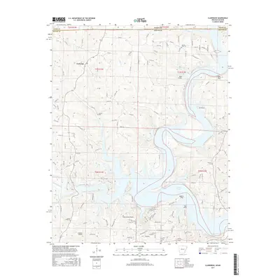
2017 Map of Clarkridge
USGS Topo · Published 2017About this map
Norfork Lake dominates the southern landscape of this Ozark plateau region, its branching fingers reaching into deep valleys like Camp Spring Hollow and Goodall Hollow. The settlement of Clarkridge sits on the higher ground to the northwest, serving as a focal point for a network of county roads that navigate the complex topography of ridges and bluffs. Significant family and community history is anchored by several burial grounds, including Bentley Ridge Cem, Thacker Cem, Maynard Cem, and Quality Ridge Cem. Along the eastern shore, prominent elevations such as Lake Point Bluff and Bean Bluff overlook the water, while residential developments like Mallard Point and Teal Point show the transition toward a recreation-oriented landscape. The state line between Missouri and Arkansas cuts across the northern edge of the map, dividing the terrain between Baxter County and Ozark County.
Find a feature on this map
119 named features on this map. Tap any name to fly to it.
Don’t see what you’re looking for? This feature index may not catch every label — zoom into the map to look around manually.
Map Details
Editions of this 2017 Clarkridge Map
This is the sole edition of this map. No revisions or reprints were ever made.
Other maps of this area

1890 · Mountain Home
USGS Topo · 1:125,000

1891 · Mountain Home
USGS Topo · 1:125,000

1894 · Mountain Home
USGS Topo · 1:125,000

1934 · Gainesville
USGS Topo · 1:48,000

1940 · Gainesville
USGS Topo · 1:62,500

1944 · Cureall
USGS Topo · 1:62,500

1945 · Harrison
USGS Topo · 1:250,000

1946 · Cureall
USGS Topo · 1:62,500

1949 · Harrison
USGS Topo · 1:250,000

1954 · Harrison
USGS Topo · 1:250,000