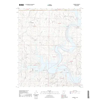
2020 Map of Clarkridge
USGS Topo · Published 2020About this map
Clarkridge sits near the northern boundary where Ozark and Baxter counties meet along the Missouri-Arkansas state line. This landscape is defined by the reaching fingers of Norfork Lake, where rising waters have filled deep-cut drainages like Goodall Hollow and Camp Spring Hollow. The upland areas remain punctuated by high points such as Cedar Ridge and Lake Point Bluff, offering a view of how the topography dictated settlement patterns before and after the reservoir's creation.
Find a feature on this map
122 named features on this map. Tap any name to fly to it.
Don’t see what you’re looking for? This feature index may not catch every label — zoom into the map to look around manually.
Map Details
Editions of this 2020 Clarkridge Map
This is the sole edition of this map. No revisions or reprints were ever made.
Other maps of this area

1890 · Mountain Home
USGS Topo · 1:125,000

1891 · Mountain Home
USGS Topo · 1:125,000

1894 · Mountain Home
USGS Topo · 1:125,000

1934 · Gainesville
USGS Topo · 1:48,000

1940 · Gainesville
USGS Topo · 1:62,500

1944 · Cureall
USGS Topo · 1:62,500

1945 · Harrison
USGS Topo · 1:250,000

1946 · Cureall
USGS Topo · 1:62,500

1949 · Harrison
USGS Topo · 1:250,000

1954 · Harrison
USGS Topo · 1:250,000