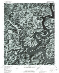
1979 Map of Clarkridge
USGS Topo · Published 1981About this map
Norfork Lake dominates this 1979 aerial orthophoto, its winding shoreline and complex inlets carving through the borderlands of Arkansas and Missouri. This particular view represents a specific moment in the land's management, produced by the U.S. Geological Survey in cooperation with the Soil Conservation Service. The photograph captures the intricate geometry of the timbered hills and agricultural clearings surrounding the settlement of Clarkridge.
Find a feature on this map
2 named features on this map. Tap any name to fly to it.
Don’t see what you’re looking for? This feature index may not catch every label — zoom into the map to look around manually.
Map Details
Editions of this 1979 Clarkridge Map
This is the sole edition of this map. No revisions or reprints were ever made.
Other maps of this area

1890 · Mountain Home
USGS Topo · 1:125,000

1891 · Mountain Home
USGS Topo · 1:125,000

1894 · Mountain Home
USGS Topo · 1:125,000

1934 · Gainesville
USGS Topo · 1:48,000

1940 · Gainesville
USGS Topo · 1:62,500

1944 · Cureall
USGS Topo · 1:62,500

1945 · Harrison
USGS Topo · 1:250,000

1946 · Cureall
USGS Topo · 1:62,500

1949 · Harrison
USGS Topo · 1:250,000

1954 · Harrison
USGS Topo · 1:250,000