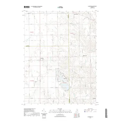
2019 Map of Clarksburg
USGS Topo · Published 2019About this map
Lake Santee and its surrounding residential developments serve as a central modern landmark in this corner of rural Indiana, where the borders of Rush, Decatur, and Franklin Counties converge. The landscape is defined by the intricate drainage networks of the Righthand Fork Salt Cr and the Middle Br Clifty Cr, which carve through the agricultural uplands. Small, long-established settlements such as Clarksburg, Andersonville, and Buena Vista remain key centers of community life, each anchored by local landmarks. For those exploring family history, the map provides precise locations for several burial grounds, including Richland Cem, Clarksburg Cem, and Mount Carmel Cem. The transition from the rectilinear grid of county roads to the winding paths near the S Fork Little Salt Cr reflects the shifting topography of this region.
Find a feature on this map
91 named features on this map. Tap any name to fly to it.
Don’t see what you’re looking for? This feature index may not catch every label — zoom into the map to look around manually.
Map Details
Editions of this 2019 Clarksburg Map
This is the sole edition of this map. No revisions or reprints were ever made.
Other maps of this area

1946 · Batesville
USGS Topo · 1:24,000

1946 · New Point
USGS Topo · 1:24,000

1953 · Cincinnati
USGS Topo · 1:250,000

1956 · Alpine
USGS Topo · 1:24,000

1956 · Metamora
USGS Topo · 1:24,000

1957 · Cincinnati
USGS Topo · 1:250,000

1958 · Greensburg
USGS Topo · 1:24,000

1958 · Clarksburg
USGS Topo · 1:24,000

1959 · Milroy
USGS Topo · 1:24,000

1959 · Rushville
USGS Topo · 1:24,000