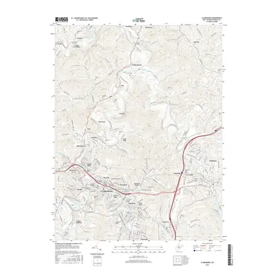
2016 Map of Clarksburg
USGS Topo · Published 2016About this map
Clarksburg anchors this survey of north-central West Virginia, where the West Fork River meets Elk Creek. The landscape reflects a legacy of extraction and industrial development, prominently featuring the Laura Lee Mine near Cambria and the many neighborhoods that grew around the core city, including Adamston, Stealey, and Broad Oaks. Transportation history is visible through the conversion of old rail corridors into the Harrison N Rail-Trail and Harrison Co Southern Rail-Trail, tracing routes that once served the region's mines and mills. Local heritage is preserved in numerous family and community burial grounds such as Robinson Cem, Garrett Cem, and Hepzibah Cem. The confluence of river valleys and steep ridges like Pinnickinnick Mtn dictates the settlement patterns, with development concentrated along the flats and crossing the water via structures like the Adamston Bridge and Sixth Street Bridge.
Find a feature on this map
105 named features on this map. Tap any name to fly to it.
Don’t see what you’re looking for? This feature index may not catch every label — zoom into the map to look around manually.
Map Details
Editions of this 2016 Clarksburg Map
This is the sole edition of this map. No revisions or reprints were ever made.
Other maps of this area

1902 · Clarksburg
USGS Topo · 1:62,500

1902 · Fairmont
USGS Topo · 1:62,500

1904 · Philippi
USGS Topo · 1:62,500

1904 · Weston
USGS Topo · 1:62,500

1910 · Clarksburg
USGS Topo · 1:62,500

1923 · Fairmont
USGS Topo · 1:62,500

1923 · Clarksburg
USGS Topo · 1:62,500

1925 · Clarksburg
USGS Topo · 1:62,500

1925 · Philippi
USGS Topo · 1:62,500

1926 · Fairmont
USGS Topo · 1:62,500