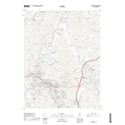
2019 Map of Clarksburg
USGS Topo · Published 2019About this map
Clarksburg and its surrounding coal-country settlements define this river-valley landscape in north-central West Virginia. The city's industrial footprint is anchored by the W Fork River and Elk Creek, where a series of historic crossings like the Adamston Bridge and Fourth Street Bridge connect dense urban neighborhoods. To the north, the terrain is marked by the legacy of resource extraction, visible at the Laura Lee Mine near Lumberport. The conversion of industrial infrastructure into recreational corridors is evident in the Harrison N Rail-Trail and the American Discovery Trail, which now track the former paths of transport through the hills.
Find a feature on this map
88 named features on this map. Tap any name to fly to it.
Don’t see what you’re looking for? This feature index may not catch every label — zoom into the map to look around manually.
Map Details
Editions of this 2019 Clarksburg Map
This is the sole edition of this map. No revisions or reprints were ever made.
Other maps of this area

1902 · Clarksburg
USGS Topo · 1:62,500

1902 · Fairmont
USGS Topo · 1:62,500

1904 · Philippi
USGS Topo · 1:62,500

1904 · Weston
USGS Topo · 1:62,500

1910 · Clarksburg
USGS Topo · 1:62,500

1923 · Fairmont
USGS Topo · 1:62,500

1923 · Clarksburg
USGS Topo · 1:62,500

1925 · Clarksburg
USGS Topo · 1:62,500

1925 · Philippi
USGS Topo · 1:62,500

1926 · Fairmont
USGS Topo · 1:62,500