
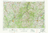
1956 Map of Clarksburg
USGS Topo · Published 1966About this map
The Ohio River valley anchors this mid-century view of the Appalachian plateau, serving as the border between Ohio and West Virginia. This region is defined by its industrial and transport arteries, notably the Baltimore and Ohio RR and the Pennsylvania RR, which follow the winding river valleys to connect major hubs like Zanesville and Parkersburg. The rugged landscape is punctuated by numerous ridges such as Fork Ridge and Laurel Ridge, illustrating the difficult terrain that dictated early settlement patterns and the placement of mountain roads like U S 50.
Find a feature on this map
83 named features on this map. Tap any name to fly to it.
Don’t see what you’re looking for? This feature index may not catch every label — zoom into the map to look around manually.
Map Details
Editions of this 1956 Clarksburg Map
2 editions found
Other maps of this area

1886 · St. George
USGS Topo · 1:125,000

1889 · Beverly
USGS Topo · 1:125,000

1891 · St. George
USGS Topo · 1:125,000

1892 · Beverly
USGS Topo · 1:125,000

1893 · Buckhannon
USGS Topo · 1:125,000

1893 · Sutton
USGS Topo · 1:125,000

1896 · Buckhannon
USGS Topo · 1:125,000

1897 · Buckhannon
USGS Topo · 1:125,000

1900 · Masontown
USGS Topo · 1:62,500

1901 · Amity
USGS Topo · 1:62,500