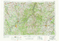
1956 Map of Clarksburg
USGS Topo · Published 1976About this map
The Ohio River corridor serves as the central artery for this mid-century landscape, linking industrial centers from Parkersburg and Marietta northward toward Moundsville. The terrain transitions from the river bottomlands into the deeply dissected plateaus of West Virginia and Ohio, where the Wayne National Forest and Blue Rock State Forest preserve large tracts of timberland. Transportation networks dominate the local economy, with the Baltimore and Ohio RR and Pennsylvania RR following the natural contours of the hills to connect coal-mining and manufacturing hubs like Clarksburg, Fairmont, and Zanesville.
Find a feature on this map
67 named features on this map. Tap any name to fly to it.
Don’t see what you’re looking for? This feature index may not catch every label — zoom into the map to look around manually.
Map Details
Editions of this 1956 Clarksburg Map
2 editions found

Other maps of this area

1886 · St. George
USGS Topo · 1:125,000

1889 · Beverly
USGS Topo · 1:125,000

1891 · St. George
USGS Topo · 1:125,000

1892 · Beverly
USGS Topo · 1:125,000

1893 · Buckhannon
USGS Topo · 1:125,000

1893 · Sutton
USGS Topo · 1:125,000

1896 · Buckhannon
USGS Topo · 1:125,000

1897 · Buckhannon
USGS Topo · 1:125,000

1900 · Masontown
USGS Topo · 1:62,500

1901 · Amity
USGS Topo · 1:62,500