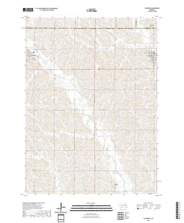
2021 Map of Clarkson
USGS Topo · Published 2021About this map
The rolling agricultural landscape of northern Colfax Co is defined by the branching tributaries of Maple Creek. The communities of Clarkson and Howells anchor the northern tier of the sheet, where a grid of rural roads like Co RD Y and Road W navigate the local drainages. Farther south, the smaller settlement of Heun sits near the W Fork Maple Cr, illustrating the typical township-and-range settlement pattern of the eastern Nebraska plains. Near the intersection of the Stanton Co, Cuming Co, and Colfax county lines, Saint John's Nepomucene Catholic Cem stands as a focal point for local genealogical research. This contemporary survey preserves the names of early town streets, such as Marion St and Elm St, alongside the established section lines that have organized these farming communities for generations.
Find a feature on this map
50 named features on this map. Tap any name to fly to it.
Don’t see what you’re looking for? This feature index may not catch every label — zoom into the map to look around manually.
Map Details
Editions of this 2021 Clarkson Map
This is the sole edition of this map. No revisions or reprints were ever made.
Other maps of this area

1955 · Fremont
USGS Topo · 1:250,000

1957 · Fremont
USGS Topo · 1:250,000

1958 · Fremont
USGS Topo · 1:250,000

1966 · Clarkson SW
USGS Topo · 1:24,000

1966 · Aloys
USGS Topo · 1:24,000

1966 · Clarkson
USGS Topo · 1:24,000
1966 · Stanton SE
USGS Topo · 1:24,000
1966 · Stanton SW
USGS Topo · 1:24,000

1966 · Dodge SW
USGS Topo · 1:24,000
1966 · Dodge
USGS Topo · 1:24,000