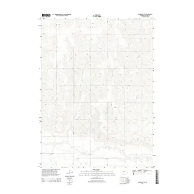
2014 Map of Clarkson SW
USGS Topo · Published 2014About this map
Shell Creek meanders across the southern reach of this agricultural landscape in Colfax County, defining the primary drainage pattern of the region. The terrain is structured by a rigorous section-line road grid, including routes such as Road I and Road L, which connect scattered farmsteads across the rolling Nebraska prairie. Water management is a visible priority on the land, evidenced by small-scale impoundments like Ternes Reservoir in the northeast and Bur Oak Reservoir near the center of the quadrangle. Several intermittent waterways, including Taylor Creek and the South Fork Dry Creek, carve shallow valleys through the fields. This survey illustrates the persistent rural character of the area, where the economy remains tied to the soil and the seasonal flow of its creeks and reservoirs.
Find a feature on this map
24 named features on this map. Tap any name to fly to it.
Don’t see what you’re looking for? This feature index may not catch every label — zoom into the map to look around manually.
Map Details
Editions of this 2014 Clarkson SW Map
This is the sole edition of this map. No revisions or reprints were ever made.
Other maps of this area

1899 · David City
USGS Topo · 1:125,000

1955 · Fremont
USGS Topo · 1:250,000

1957 · Fremont
USGS Topo · 1:250,000

1958 · Fremont
USGS Topo · 1:250,000

1958 · Columbus
USGS Topo · 1:24,000

1966 · Clarkson SW
USGS Topo · 1:24,000

1966 · Humphrey SE
USGS Topo · 1:24,000

1966 · Clarkson
USGS Topo · 1:24,000

1966 · Creston
USGS Topo · 1:24,000
1966 · Leigh
USGS Topo · 1:24,000