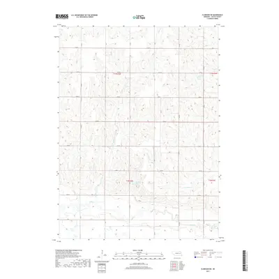
2017 Map of Clarkson SW
USGS Topo · Published 2017About this map
The agrarian landscape of Colfax County is defined by the winding course of Shell Creek and its various tributaries that carve through the Nebraska plains. This 2017 survey details a highly organized section of the Public Land Survey System, where a grid of rural roads such as Co RD P and Co RD J facilitate access to the surrounding farmsteads and fields. Water management is a central feature of the local topography, highlighted by the presence of Bur Oak Reservoir and Ternes Reservoir. These man-made features, alongside smaller streams like Taylor Cr and S Fork Dry Cr, illustrate the essential relationship between the local geography and the agricultural economy of the region. The map provides a precise look at the township and range divisions, including t18n r2e and t19n r3e, which remain foundational to property and local history in this part of the state.
Find a feature on this map
23 named features on this map. Tap any name to fly to it.
Don’t see what you’re looking for? This feature index may not catch every label — zoom into the map to look around manually.
Map Details
Editions of this 2017 Clarkson SW Map
This is the sole edition of this map. No revisions or reprints were ever made.
Other maps of this area

1899 · David City
USGS Topo · 1:125,000

1955 · Fremont
USGS Topo · 1:250,000

1957 · Fremont
USGS Topo · 1:250,000

1958 · Fremont
USGS Topo · 1:250,000

1958 · Columbus
USGS Topo · 1:24,000

1966 · Clarkson SW
USGS Topo · 1:24,000

1966 · Humphrey SE
USGS Topo · 1:24,000

1966 · Clarkson
USGS Topo · 1:24,000

1966 · Creston
USGS Topo · 1:24,000
1966 · Leigh
USGS Topo · 1:24,000