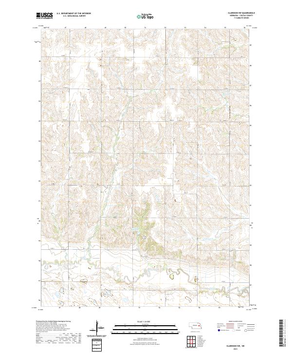
2021 Map of Clarkson SW
USGS Topo · Published 2021About this map
Shell Creek meanders through this portion of Colfax County, defining a landscape dominated by agriculture and sophisticated water management. The terrain is structured by a rigorous grid of section lines and county roads, reflecting the systematic land division of the Public Land Survey System across the Nebraska prairie. This survey identifies critical local water resources like the Bur Oak Reservoir and Ternes Reservoir, which support the rural economy in an area where small tributaries such as Taylor Cr and S Fork Dry Cr feed into the larger creek system. The map captures a moment in the early 21st century where the enduring rural framework of the Great Plains remains the primary organizational force of the region.
Find a feature on this map
24 named features on this map. Tap any name to fly to it.
Don’t see what you’re looking for? This feature index may not catch every label — zoom into the map to look around manually.
Map Details
Editions of this 2021 Clarkson SW Map
This is the sole edition of this map. No revisions or reprints were ever made.
Other maps of this area

1899 · David City
USGS Topo · 1:125,000

1955 · Fremont
USGS Topo · 1:250,000

1957 · Fremont
USGS Topo · 1:250,000

1958 · Fremont
USGS Topo · 1:250,000

1958 · Columbus
USGS Topo · 1:24,000

1966 · Clarkson SW
USGS Topo · 1:24,000

1966 · Humphrey SE
USGS Topo · 1:24,000

1966 · Clarkson
USGS Topo · 1:24,000

1966 · Creston
USGS Topo · 1:24,000
1966 · Leigh
USGS Topo · 1:24,000