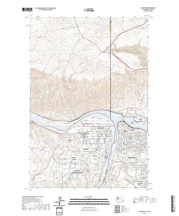
2023 Map of Clarkston
USGS Topo · Published 2023About this map
The Snake River and Clearwater River converge here, anchoring a complex urban landscape where the Washington-Idaho border splits the communities of Clarkston and Lewiston. This contemporary look at the valley reveals the dense residential and institutional development of West Clarkston-Highland and Lewiston Orchards, connected by a network of industrial corridors such as Port Way and Wawawai River Rd. The terrain is defined by dramatic elevation changes, most notably at Lewiston Hill, where the Old Spiral Hwy provides a historical contrast to modern thoroughfares like the Access Rd near the Whitman and Nez Perce county line.
Find a feature on this map
113 named features on this map. Tap any name to fly to it.
Don’t see what you’re looking for? This feature index may not catch every label — zoom into the map to look around manually.
Map Details
Editions of this 2023 Clarkston Map
This is the sole edition of this map. No revisions or reprints were ever made.
Other maps of this area

1910 · Pullman
USGS Topo · 1:125,000

1945 · Clarkston
USGS Topo · 1:62,500

1948 · Clarkston
USGS Topo · 1:62,500

1955 · Pullman
USGS Topo · 1:250,000

1958 · Pullman
USGS Topo · 1:250,000

1958 · Lewiston Orchards North
USGS Topo · 1:24,000

1958 · Lewiston Orchards South
USGS Topo · 1:24,000

1958 · Lewiston Orchards
USGS Topo · 1:62,500

1961 · Moscow
USGS Topo · 1:62,500

1964 · Colton
USGS Topo · 1:24,000