
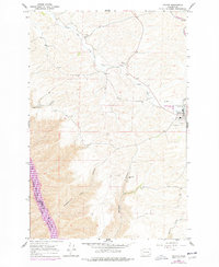
1964 Map of Colton
USGS Topo · Published 1965About this map
Colton serves as the primary hub of this 1960s agricultural landscape, situated along 195 and the Northern Pacific railroad. The topography is defined by the dramatic descent from the rolling highlands of Indian Prairie into the deep, etched drainages of Yakawawa Canyon, Nisqually John Canyon, and Steptoe Canyon as they approach the Snake River. This river corridor marks the county line between Whitman and Garfield counties, where the rugged terrain meets the water's edge. Local infrastructure is concentrated in the town of Colton, featuring a High School, storage bins for the region's grain harvest, and a local cemetery. Further into the interior, the Nesterbank Ranch and various gravel pits reflect the rural industry and family landholdings that shaped the Palouse region's development during the mid-20th century.
Find a feature on this map
20 named features on this map. Tap any name to fly to it.
Don’t see what you’re looking for? This feature index may not catch every label — zoom into the map to look around manually.
Map Details
Editions of this 1964 Colton Map
2 editions found
Other maps of this area

1910 · Pullman
USGS Topo · 1:125,000

1943 · Peola
USGS Topo · 1:62,500

1945 · Clarkston
USGS Topo · 1:62,500

1946 · Peola
USGS Topo · 1:62,500

1948 · Clarkston
USGS Topo · 1:62,500

1955 · Pullman
USGS Topo · 1:250,000

1958 · Pullman
USGS Topo · 1:250,000

1964 · Moscow West
USGS Topo · 1:24,000

1964 · Ewartsville
USGS Topo · 1:24,000

1964 · Bishop
USGS Topo · 1:24,000