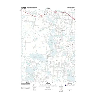
2011 Map of Clarkston
USGS Topo · Published 2011About this map
Glacial topography and a high density of kettle lakes define the corridor between Clarkston and Waterford in Oakland County. The landscape is a complex mosaic of water bodies, including the sprawling Pontiac Lake, Maceday Lake, and Williams Lake, which are interconnected by the winding Huron River and Clinton River. This intricate drainage system historically influenced the development of early settlements like Drayton Plains and Oxbow, where residential growth is woven around the shorelines. Evidence of the area's local heritage is preserved in numerous burial grounds, such as Bridge Lake Cemetery and Lakeview Cemetery, which sit alongside historic transit routes like Dixie Hwy. The southern portion of the map is anchored by the Oakland-Pontiac Airport, illustrating the transition from rural lakefront retreats to a modern suburban and regional transportation hub.
Find a feature on this map
71 named features on this map. Tap any name to fly to it.
Don’t see what you’re looking for? This feature index may not catch every label — zoom into the map to look around manually.
Map Details
Editions of this 2011 Clarkston Map
This is the sole edition of this map. No revisions or reprints were ever made.
Other maps of this area

1907 · Pontiac
USGS Topo · 1:62,500

1909 · Milford
USGS Topo · 1:62,500

1920 · Holly
USGS Topo · 1:62,500

1922 · Holly
USGS Topo · 1:62,500

1936 · Wixom
USGS Topo · 1:31,680

1936 · Highland
USGS Topo · 1:31,680

1936 · Clarkston
USGS Topo · 1:31,680

1936 · Walled Lake
USGS Topo · 1:31,680

1936 · Pontiac South
USGS Topo · 1:31,680

1936 · Pontiac North
USGS Topo · 1:31,680
Featured Places
- Waterford Township, MI
- Independence Charter Township, MI
- White Lake Charter Township, MI
- Springfield Charter Township, MI
- Clarkston, MI