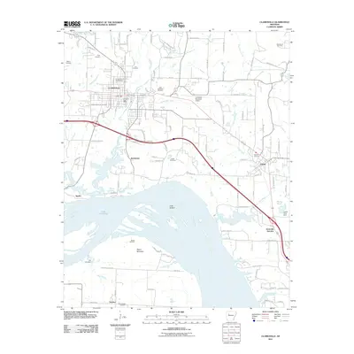
2011 Map of Clarksville
USGS Topo · Published 2011About this map
The University of the Ozarks anchors the northern portion of this Arkansas River valley landscape, reflecting the educational and cultural center of Clarksville. To the south, the terrain descends toward the wide expanse of the Arkansas River and Lake Dardanelle, where industrial and agricultural history converge at the Spadra Gas Field and the broad alluvial plains of Cuba Bottom. The transportation network is dominated by the corridor passing through Jamestown and Lamar, connecting local centers to Knoxville Junction. Local heritage is preserved in numerous family and community burial grounds, including the Macedonia Cemetery and Ware Chapel Cemetery, while natural drainages like Spadra Creek and Greenbrier Creek define the local topography before they meet the river.
Find a feature on this map
106 named features on this map. Tap any name to fly to it.
Don’t see what you’re looking for? This feature index may not catch every label — zoom into the map to look around manually.
Map Details
Editions of this 2011 Clarksville Map
This is the sole edition of this map. No revisions or reprints were ever made.
Other maps of this area

1887 · Magazine Mountain #1
USGS Topo · 1:62,500

1887 · Magazine Mountain
USGS Topo · 1:62,500

1888 · Dardanelle #2
USGS Topo · 1:62,500

1889 · Ozone
USGS Topo · 1:62,500

1890 · Magazine Mountain
USGS Topo · 1:125,000

1890 · Dardanelle
USGS Topo · 1:125,000

1906 · Batson
USGS Topo · 1:62,500

1934 · Ozone
USGS Topo · 1:62,500

1936 · Ozone
USGS Topo · 1:62,500

1956 · Russellville
USGS Topo · 1:250,000