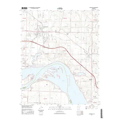
2017 Map of Clarksville
USGS Topo · Published 2017About this map
Clarksville serves as the regional anchor for this part of Johnson County, situated north of the expansive Lake Dardanelle along the Arkansas River. The landscape is a transition from the urban footprint of the Univ of the Ozarks and Clarksville Municipal Airport to the agricultural lowlands of Cuba Bottom and the prominence of Ragon Mtn. The transport network is well-defined by historical routes like State Hwy 123 and Old Hwy 64 N, connecting the primary hub with peripheral communities such as Lamar, Knoxville, and Jamestown. Local history is deeply etched into the terrain through numerous family and community burial grounds, including Macedonia Cem, Lee Cem, and Pryor Cem. Waterways like Spadra Cr and Greenbrier Cr continue to shape the drainage patterns of the valley, while smaller settlements like Tokalon and Knoxville Junction mark old railway or road intersections.
Find a feature on this map
55 named features on this map. Tap any name to fly to it.
Don’t see what you’re looking for? This feature index may not catch every label — zoom into the map to look around manually.
Map Details
Editions of this 2017 Clarksville Map
This is the sole edition of this map. No revisions or reprints were ever made.
Other maps of this area

1887 · Magazine Mountain #1
USGS Topo · 1:62,500

1887 · Magazine Mountain
USGS Topo · 1:62,500

1888 · Dardanelle #2
USGS Topo · 1:62,500

1889 · Ozone
USGS Topo · 1:62,500

1890 · Magazine Mountain
USGS Topo · 1:125,000

1890 · Dardanelle
USGS Topo · 1:125,000

1906 · Batson
USGS Topo · 1:62,500

1934 · Ozone
USGS Topo · 1:62,500

1936 · Ozone
USGS Topo · 1:62,500

1956 · Russellville
USGS Topo · 1:250,000