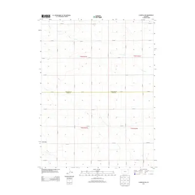
2013 Map of Clarkville NE
USGS Topo · Published 2013About this map
Clarkville sits at the southwestern edge of this High Plains landscape, marking a small pocket of settlement in an area otherwise defined by broad agricultural divisions. The terrain is structured by a dense grid of county roads, including Co Road 2, which serves as the physical boundary between Phillips County and Yuma County. The most significant natural drainage is provided by Patent Creek, or Patent Cr, which winds through the northern sections of the map, carving subtle variations into the township and range grid. This 2013 survey illustrates the enduring patterns of the Public Land Survey System, specifically within t006n r047w and t005n r047w, where the regularity of the road network reflects the systematic organization of eastern Colorado's ranching and farming lands.
Find a feature on this map
29 named features on this map. Tap any name to fly to it.
Don’t see what you’re looking for? This feature index may not catch every label — zoom into the map to look around manually.
Map Details
Editions of this 2013 Clarkville NE Map
This is the sole edition of this map. No revisions or reprints were ever made.
Other maps of this area

1954 · Sterling
USGS Topo · 1:250,000

1958 · Sterling
USGS Topo · 1:250,000

1971 · Paoli
USGS Topo · 1:24,000

1971 · Fiddler Peak
USGS Topo · 1:24,000

1971 · Clarkville NE
USGS Topo · 1:24,000

1971 · Haxtun SE
USGS Topo · 1:24,000

1971 · Clarkville SE
USGS Topo · 1:24,000

1971 · Old Baldy
USGS Topo · 1:24,000

1972 · Clarkville
USGS Topo · 1:24,000

1972 · Rockland
USGS Topo · 1:24,000